 |
Walking
|
Computer Support
Walking
Explore the Area
The Glenholm Centre
Broughton
By Biggar
Scottish Borders
ML12 6JF
01899 830408
![]()
| Glenholm |
| The Farm |
| Way-Marked Walks |
| Farm Etiquette |
| Getting Here |
| Parking |
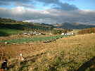
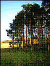
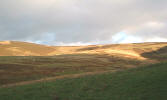
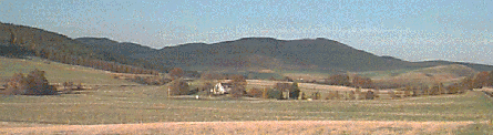
Come walking in the beautiful glen of the Holms Water in the Scottish Borders. Near the village of Broughton between Peebles and Biggar, and just 30 miles south of Edinburgh, it is an ideal place to come for a quiet stroll and picnic by the river or a more strenuous hill climb.

| Top |
Glenholm
Glenholm is a small community at the heart of the Holms Water glen, once served by a church and school. Although neither are any longer in use, one corner of the church still remains and is set within the old churchyard. The school was closed in 1943 but the old school building still exists.
| Top |
The Farm
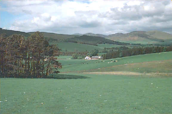
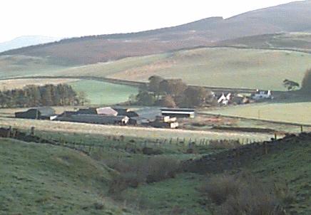
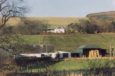
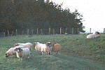
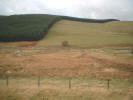
Glenholm is surrounded by Cardon Farm, a working upland sheep farm of approximately 1000 acres. Once supporting a farm manager, a shepherd and their families, now it is dependent on supplementary incomes and external subsidies to survive.
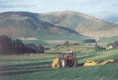
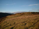
The farm can be divided into three areas. The first area, the low ground, is stocked with cattle and sheep but also has arable fields sown with barley, rape and grass. The north-west hill is permanent grassland with cattle and sheep, while the south-east hill is heather and stocked with blackface sheep.
| Top |
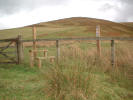
Three routes help you to explore the farm. These were way marked and stiles were installed as part of the Glenholm Wildlife Project. They all start at Glenholm (230m). Maps and directions of each walk may also be displayed using the icon alongside each walk's description. Each walk is also described in more detail on the Glenholm Wildlife Project Upland Walks page.
![]() ►The
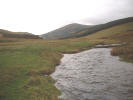
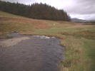
Riverside Walk is a gentle walk of about 2 kilometres which goes up the Holms
Water glen using the glen road at the valley's edge and returns along the
riverside. Although wet in places there are no stiles and the route is usually
suitable for walkers with dogs.
►The
Riverside Walk is a gentle walk of about 2 kilometres which goes up the Holms
Water glen using the glen road at the valley's edge and returns along the
riverside. Although wet in places there are no stiles and the route is usually
suitable for walkers with dogs.
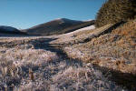
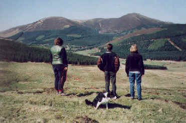
![]() ►The Fort
Walk is just over 3 kilometres in length. It starts along the glen road at the
edge of the valley floor, then follows a path up a gulley which cuts into the
hill on the south-east side of the valley. Almost at the head of the gulley the
route climbs quite steeply to the Chester Rig fort (333m), a fine two-ringed
Iron Age fort and well worth a view.
►The Fort
Walk is just over 3 kilometres in length. It starts along the glen road at the
edge of the valley floor, then follows a path up a gulley which cuts into the
hill on the south-east side of the valley. Almost at the head of the gulley the
route climbs quite steeply to the Chester Rig fort (333m), a fine two-ringed
Iron Age fort and well worth a view.
From the fort the route follows a more gentle path back down to the road and back to Glenholm. Some parts of the walk may be wet. There are two stiles but both are alongside gates so this route is usually suitable for walkers with dogs. Please observe the farm etiquette suggestions before setting out.
![]() ►The
Blakehope Walk is a longer walk of six and a half kilometres and extends the
Fort Walk up to the farm boundary near Chester Rig Head (448m) and optionally to
the summit of Blakehope Head (542m). It returns by following the farm boundary
down to the eastern edge of Cardon Farm and then back to Glenholm.
►The
Blakehope Walk is a longer walk of six and a half kilometres and extends the
Fort Walk up to the farm boundary near Chester Rig Head (448m) and optionally to
the summit of Blakehope Head (542m). It returns by following the farm boundary
down to the eastern edge of Cardon Farm and then back to Glenholm.
This is a more challenging walk. Only one stile exists and it is adjacent to a gate so the walk is usually suitable for walkers with dogs. Great care must be taken of cattle and sheep, so you may need to keep your dogs on leads for much of the time. Please observe the farm etiquette suggestions before setting out.
Before setting out on any walk please read the section on farm etiquette first.
| Top |
Farm Etiquette
When walking in Glenholm please observe the following guidelines:
- Leave gates as you find them
- Keep dogs on leads when near livestock
Do not walk near sheep with dogs during March, April and May when lambing is in progress.
- Never take dogs into fields containing cows
- Avoid fields that contain cows with young calves
- Avoid walking directly across cultivated fields
- Take your litter home with you
- Avoid picking any wild flowers
Keep clear of the farm steading and all farm machinery
Avoid walking through private gardens
Please note that visitors to Glenholm explore the area at their own risk. Where possible please follow the routes which have been way marked for you.
| Top |
Getting Here
Glenholm is easily reachable by car. It is close to the A701 two miles south-west of Broughton, 6 miles east of Biggar and 12 miles west of Peebles. The A74 at Moffat is twenty miles to the south. The glen road is clearly sign-posted Glenholm. Thereafter follow the signs for the Glenholm Centre. Maps and more detailed directions may be found on their own web page.
| Top |
Parking
Visitors may no longer park at the Glenholm Centre but 400 yards up the glen just passed the cattle grid there is a small area of hard standing next to a small hut which may be used.
| op |
Broughton, by BIGGAR, Scottish Borders ML12 6JF
Telephone: 01899-830408
E-Mail: